
Click to open the image full size in a new tab or click image to view in a gallery

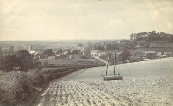
Probably the Oldest Photograph of Bere Regis; taken in 1863
This photograph was taken looking west from Woodbury Hill. It was taken by J.W.Boswell; the village's first photographer, whose other occupations included being a decorator.
The main road to Poole enters at the left of the picture, while the lane to its right is Blind Street.
The church is very prominent at the left and in its pre-restoration state.
Particularly noticeable in this early Spring photo is the lack of bushes, trees and shrubs anywhere in the village.
It is sobering to think that at this time the London Underground work began as the first underground railway in the world, while in America the Civil War was raging with the Confederates' best general Stonewall Jackson dying after being accidentally shot by one of his own sentries.
Meanwhile in China General Gordon was battling the Tai Ping rebels!
Photograph courtesy of Paul & Alison Bennett
Copyright belongs to Dorset County Museum
Westbrook Cottage, 1900

Photograph courtesy of Paul & Alison Bennett
Notice the side of the Old Vicarage showing at the top of the Hill.
.jpg)
Photograph courtesy of Paul & Alison Bennett
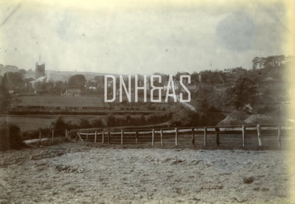
Oh to walk from Shitterton across the fields to the Church on a warm summer's evening.
Now these interlooking paddocks are paved over, but what a lovely scene it appeared then.
Shitterton really was its own little hamlet.
Photograph courtesy of Paul & Alison Bennett
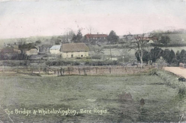
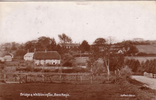
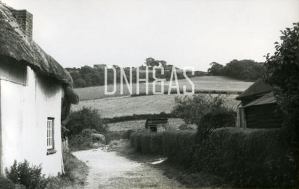
The thatch house in the foreground is still there - though now it has a modern tile roof.
White Lovington, alas, is no longer with us.
Fortunately, some of the wonderful trees collected and planted by its owner shade the houses there today.
Photograph courtesy of Paul & Alison Bennett
Bere Regis from the end of Shitterton around 1900. Notice again the patchwork fields between Shitterton & the Church.
Photograph courtesy of Paul & Alison Bennett
Bere Regis from the Poole Road around the 1930's.
This photo clearly shows the Orchard in Court Green Gardens & if you look carefully, the back of the Methodist Chapel..
Photograph courtesy of Paul & Alison Bennett
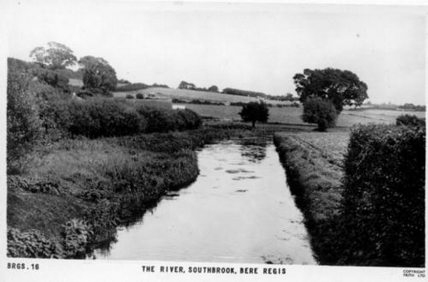
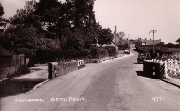
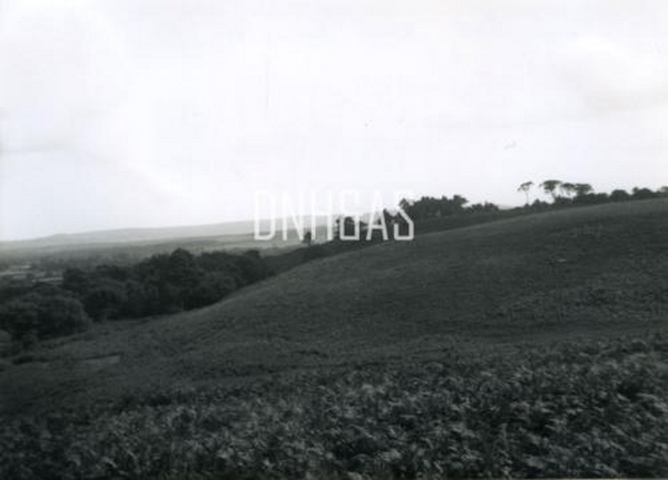
View of Southbrook from the south east. Notice the amount of heath on Black Hill.
Some of this has since been covered by woodland.
Photograph Courtesy of John Pitfield
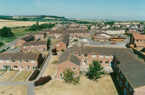
This picture, taken from the Church tower shows the extent of the 1980s building in the village. Before this area was meadow and allotments. The largest building, in the foreground, is Turberville Court, which contains flats for the elderly, while the new Clinic is also visible beyond. Interestingly, two Bere Regis Coaches are on the parking area, not far from the original bus yards belonging to the firm.
Photograph courtesy of Paul & Alison Bennett
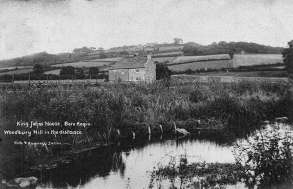
A most idyllic setting...
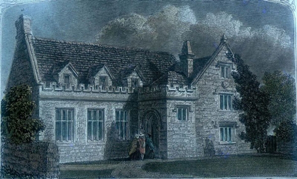
King Johns House
Late C18th engraving of how it used to look
Photograph courtesy of Paul & Alison Bennett
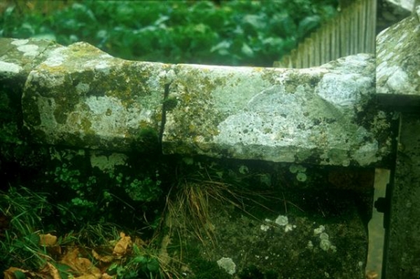
Click the image above to see one of the stones from the Old Manor House, currently part of a villagers garden wall.
When the House fell into disrepair the villagers helped themselves - now that's recycling for you!
Photograph courtesy of Paul & Alison Bennett
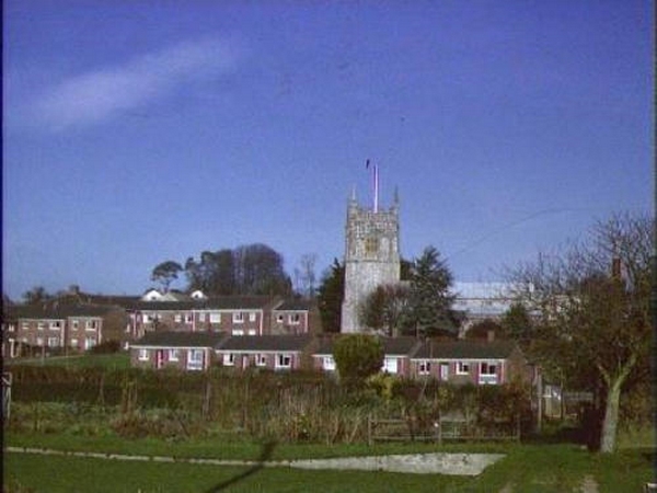
Bere Regis from Black Hill. Notice the Methodist Chapel in the middle of the photograph.
This view is looking North towards the village.
Photograph courtesy of Paul & Alison Bennett
Southbrook from the Church meadow.
These cows would today be munching through various peoples living rooms and gardens.
Notice the lovely trees surrounding White Lovington House.
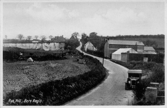
Looking up Rye Hill
Photograph courtesy of Paul & Alison Bennett
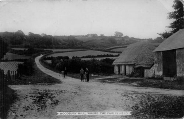
Looking east towards Woodbury Hill.
The thatch on the barn to the right looks like it is slowly oozing off the roof!
Photograph courtesy of Paul & Alison Bennett
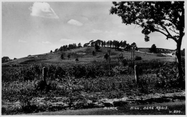
Black Hill.
You would hardly recognise the outline of the Hill today, as there are so many more trees cloaking it now.
Photograph courtesy of Paul & Alison Bennett
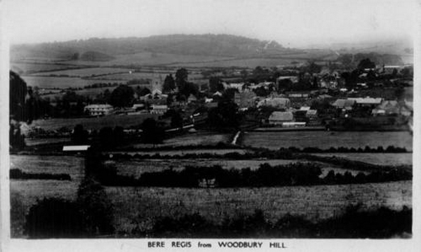
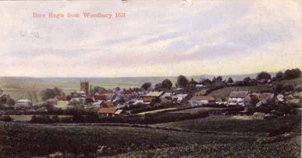
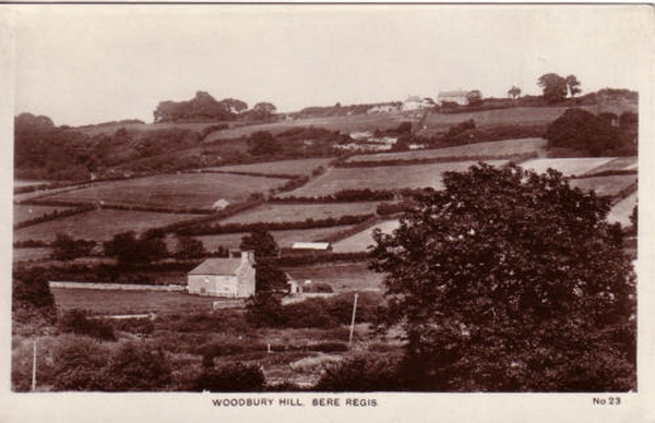
Bere Regis from Woodbury Hill.
Notice the hedgerows and field shapes in the area to the south of the village.
Most of that area has been replaced by a few larger fields.
Photograph courtesy of Paul & Alison Bennett
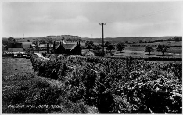
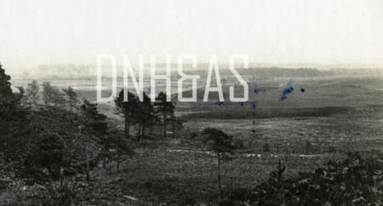
Gallows Hill.
It's remarkable how many more trees there are in this spot nowadays, compared to this photograph's time.
Photograph courtesy of Paul & Alison Bennett
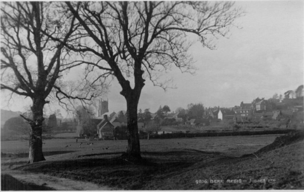
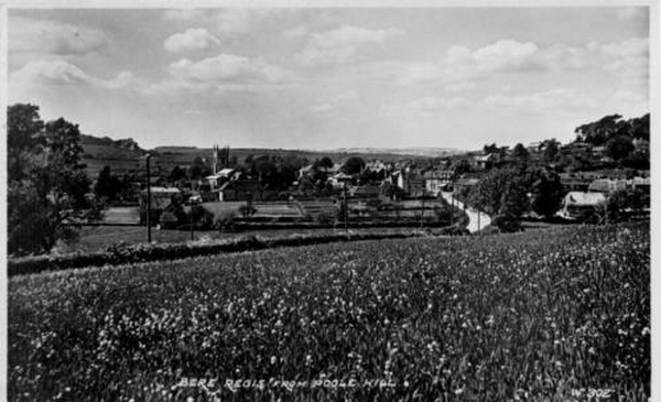
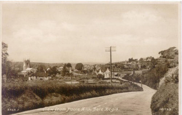
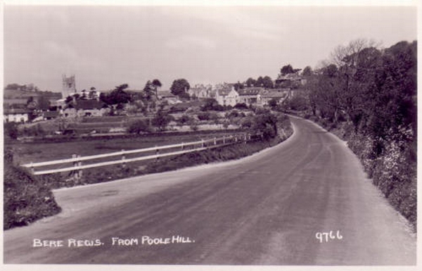
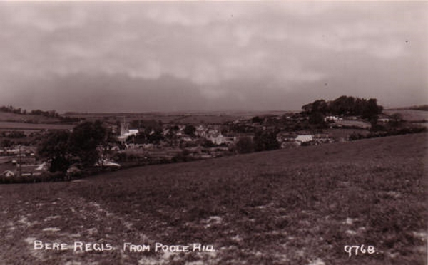
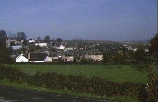
Bere Regis from Poole Hill. A lovely summers photograph of our village
Photograph courtesy of Paul & Alison Bennett
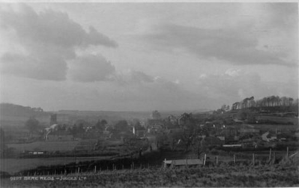
Bere Regis from the south east.
How could you tell which direction from Bere Regis we are at the moment?
You may need some divine intervention...
Photograph courtesy of Paul & Alison Bennett
Bere Stream.
The waterway that puts the Bere in Bere Regis...

Photograph courtesy of Paul & Alison Bennett
Bere Regis from the base of Woodbury Hill.
Look how small the Yew trees are in the Churchyard...
Photograph courtesy of Paul & Alison Bennett
Village view in 1954.
The eastern approaches to the village remain as green as they were in 1954.
Photograph courtesy of Paul & Alison Bennett
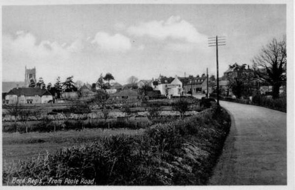
View of the Village from the Poole Road.
Look at the size of that tree behind the Vicarage!
Photograph courtesy of Paul & Alison Bennett
Hedgerows with a village in the background.... There seems to be more hedgerow than village in this photograph!
Photograph courtesy of Michael Eastman
Bere Regis Road from the East.
Notice the nice old hurdle fence to the left.
Photograph courtesy of Michael Eastman
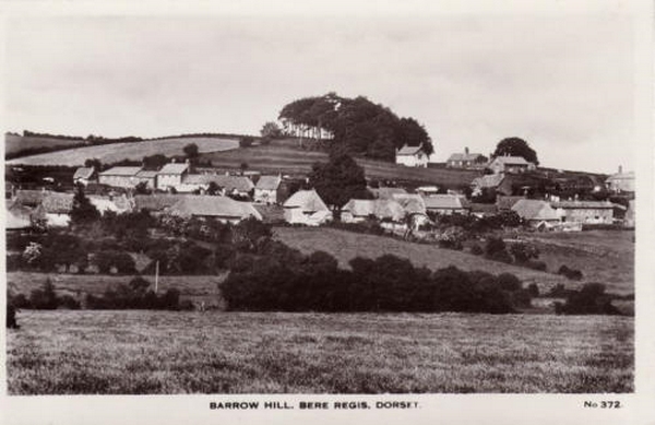
Barrow Hill.
A rare photographic angle of the village.
Photograph courtesy of Tony Bates
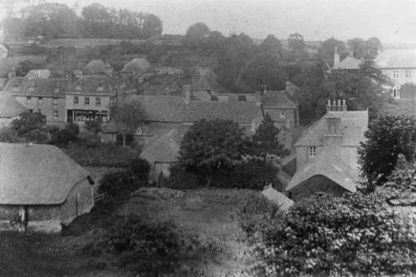
Village from Woodbury Hill in 1863.
Notice how white the gravestones look.
Photograph courtesy of Michael Eastman
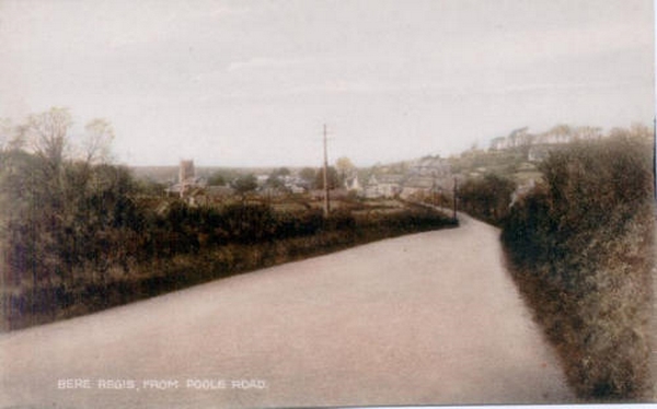
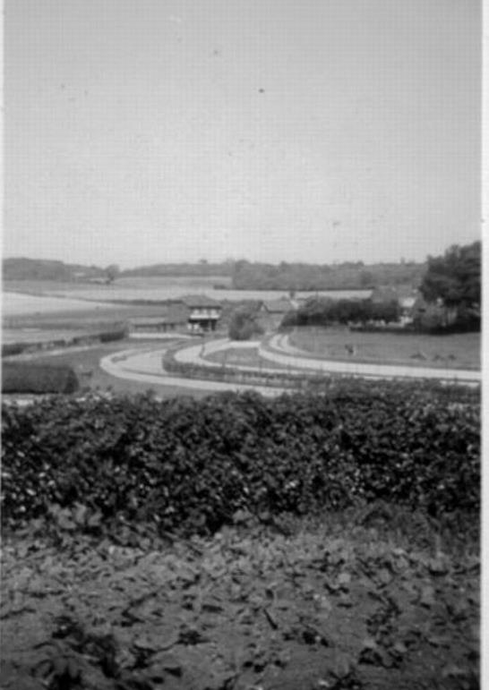
Bere Regis from the Poole Road.
A nice view for a traveller
Photograph courtesy of Michael Eastman
The village in a postcard from the early 20th Century.
Bere Regis at the turn of the last century - still sounds weird doesn't it!?!
Photograph courtesy of Tony Bates
It's a pity that there weren't more photographs taken from the church tower.
It seems such an obviously good vantage point for shots of the village.
Still, if someone out there has some, you know where to send them to!
By the way you can make out Hatton
Photograph courtesy of Michael Eastman
1980's Postcard of Bere Regis.
Duran Duran was on top of the pops when these snaps were taken!
Photograph courtesy of Michael Eastman
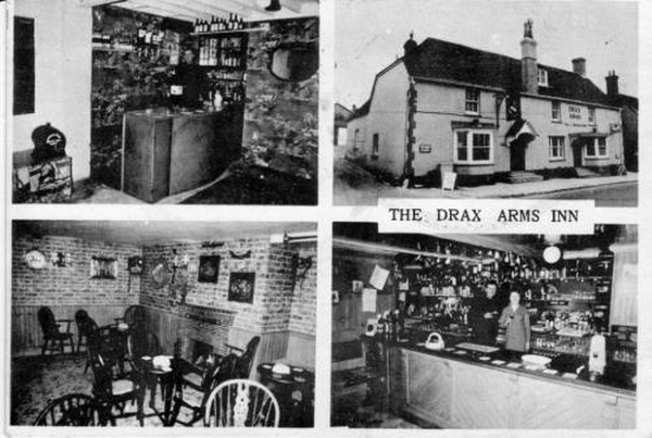
The Drax Arms in the 1970's.
Bet pints were somewhat cheaper then!
Photograph courtesy of Paul & Alison Bennett
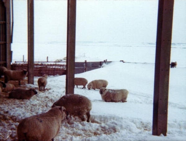
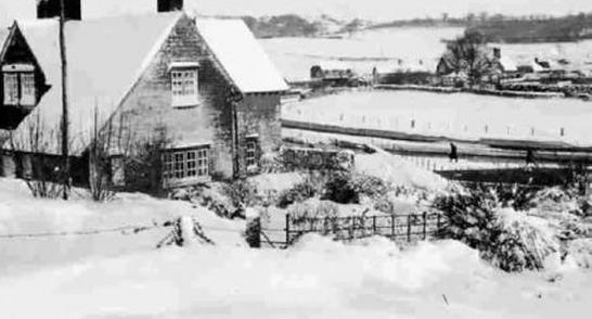
Sheep in the snow. Good thing they have those wooly coats on!
Photograph courtesy of Mark Bennett
The Village from Woodbury Hill.
This is a traditional black & white post card coloured in for publication
Photograph courtesy of Paul & Alison Bennett
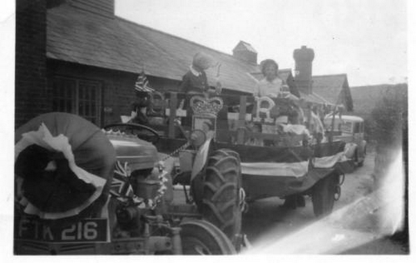
Royal Celebration.
Hope they cleaned the tractor up!
Photograph courtesy of Mark Bennett
The Village from the East.
Methinks the heavens were about to open on the poor Photographer.
Photograph courtesy of Mark Bennett
Southbrook from the South.
There is something wonderfully quaint about white picket fences.
Photograph courtesy of Mark Bennett
Court Green from the South.
A lovely photograph of Court Green nestling at the bottom of the patchwork fields on the slope of Woodbury Hill.
Photograph courtesy of Mark Bennett
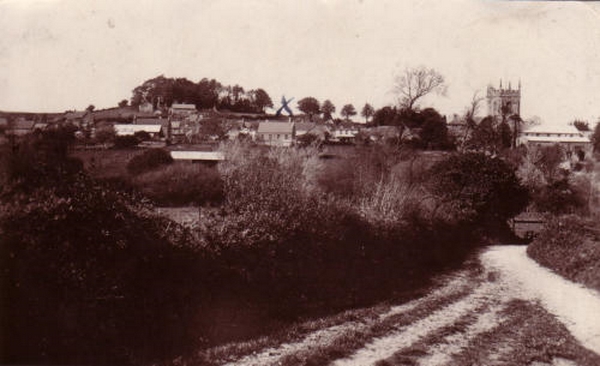
The Village from the South.
Note the single trees along the horizon - rather a nice effect...(X marks the Old Methodist Chapel)
Photograph courtesy of Mark Bennett
White Lovington House from the North.
The now demolished White Lovington House pokes towards us from its very woody garden - a result of its owner loving collecting trees
Bere Regis from the East in around 1920 by E F Adams.
Notice the pleasing line of trees in the foreground...
Photograph courtesy of Paul & Alison Bennett
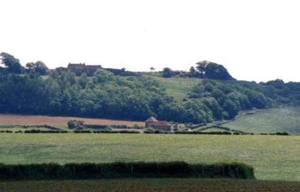
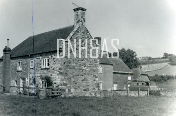
Doddings Farm.
Doddings Farm from a distance - a lovely rural setting.
Photograph courtesy of Mark Bennett
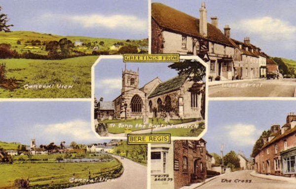
Village Postcard.
Come & visit our village.
Photograph Courtesy of John Pitfield
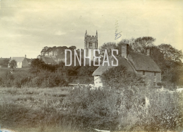
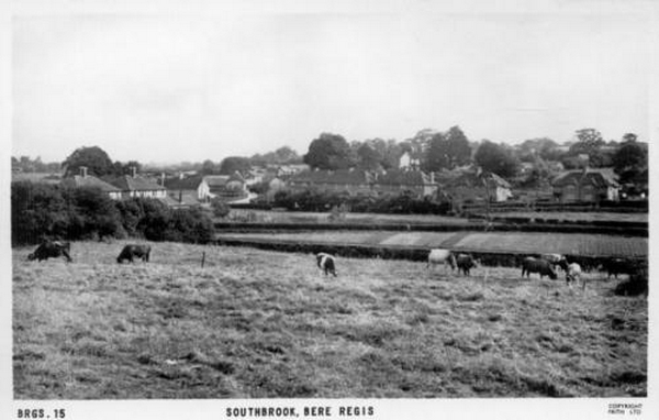
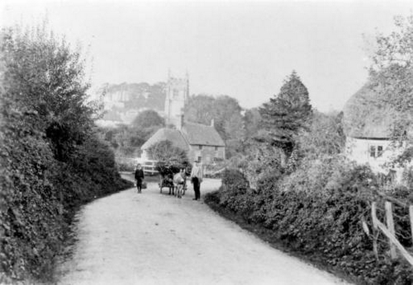
Southbrook, Bere Regis circa 1900.
Another of W. Pouncy's photographs, this one looks toward the church and includes the Westbrook cottage at centre.
At right are Number 20 and 21, while the donkey and cart have stopped to be photographed on their journey.
Photograph Courtesy of John Pitfield
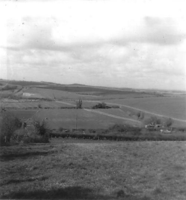
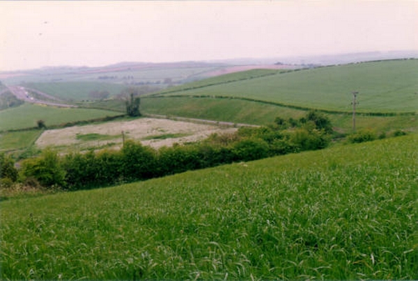
Farmland to the north of Bere Regis in the 1950's.
The Village Bypass would eventually cut through where the camera man was standing here in the 1950's.
Photograph courtesy of Paul & Alison Bennett
Bere Heath at the beginning of the 20th Century.
A few more trees would greet your eye in the modern scene.
Photograph Courtesy of John Pitfield
Demolished houses next to the Bere Regis Bypass. There used to be some houses next to the Bypass - can you imagine how noisy it must have been! In Victorian times they simply looked out over a small road to Dorchester.
Photograph Courtesy of John Pitfield
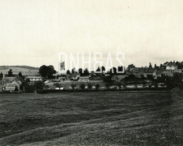
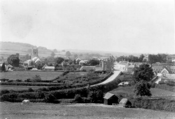
Bere Regis from the East circa 1900.
Another in Walter Pouncy's series of pictures taken at about the turn of the century.
This time the photographer has lined himself up with West Street, and particularly evident are the number of barns behind the houses
Photograph courtesy of George Ward
Looking North of the Village.
Photograph courtesy of the 1986 BBC Domesday Project
Bere Regis from the South in 1986.
This Photograph was taken by Villagers, as part of the 1986 BBC Domesday Project.
Photograph courtesy of George Ward
Woodbury Hill.
Photograph courtesy of the 1986 BBC Domesday Project
Bere Regis Church from the Watercress Beds in 1986.
This Photograph was taken by Villagers, as part of the 1986 BBC Domesday Project.
Village from Woodbury Hill in 1905.
Photograph courtesy of Justin Standfield
Doddings/Hollow Oak looking across the Watercress Beds, in circa 1950.
Photograph by Ken Standfield, looking across the Watercress Beds, from Doddings/Hollow Oak, in circa 1950
This Photograph is Copyright of Dorset County Museum.
Bere Regis from the Poole Road, in the 1920s.
This Photograph is Copyright of Dorset County Museum.
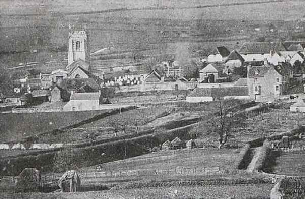
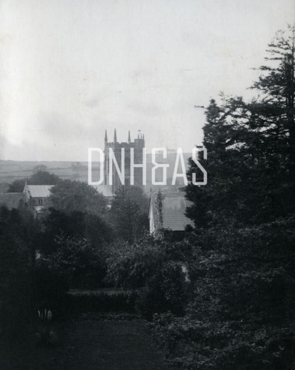
Church & Town from the Rectory Garden, before 1900.
This Photograph is Copyright of Dorset County Museum.
Blind Lane, Bere Regis, in 1972.
This Photograph is Copyright of Dorset County Museum.
Middlebere Heath in the 1920s.
This Photograph is Copyright of Dorset County Museum.
Bere Regis Manor House from the SSW, on 25/06/71.
This Photograph is Copyright of Dorset County Museum.
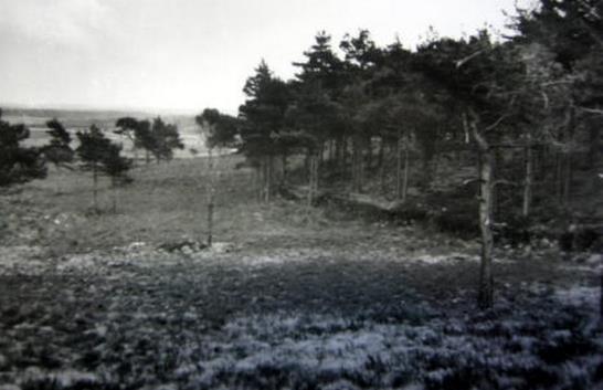
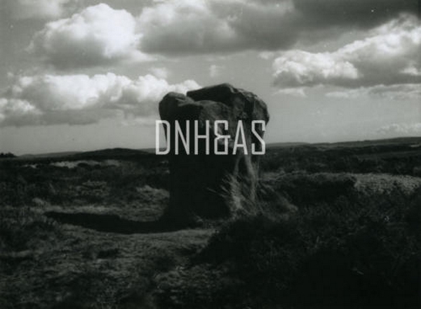
Boundary Stone on Black Hill - Bere Regis to Turnerspuddle Track, in August 1953.
This Photograph is Copyright of Dorset County Museum.
Black Hill in August 1953
This Photograph is Copyright of Dorset County Museum.
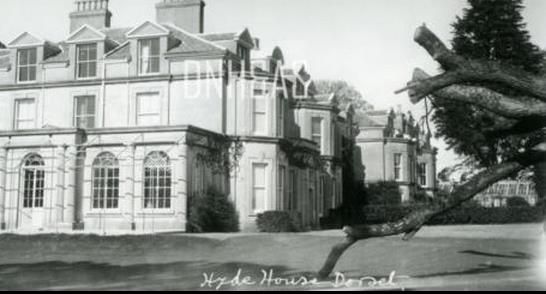
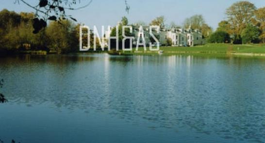
Hyde House during the 1920s - 1930s
This Photograph is Copyright of Dorset County Museum.
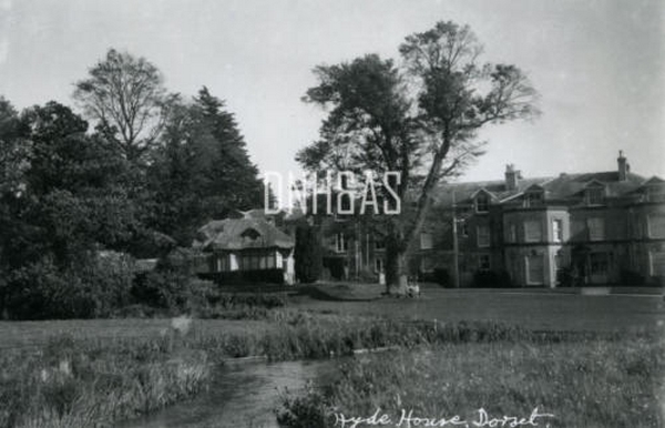
Hyde House next to the River Piddle, 1920s - 1930s.
This Photograph is Copyright of Dorset County Museum.
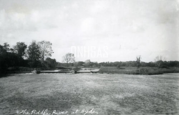
River Piddle at Hyde, 1920s - 1930s.
This Photograph is Copyright of Dorset County Museum.
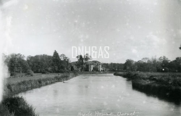
Hyde House next to the River Piddle, 1920s - 1930s.
This Photograph is Copyright of Dorset County Museum.
Hyde House shortly before it was demolished in 1999
This Photograph is Copyright of Dorset County Museum.
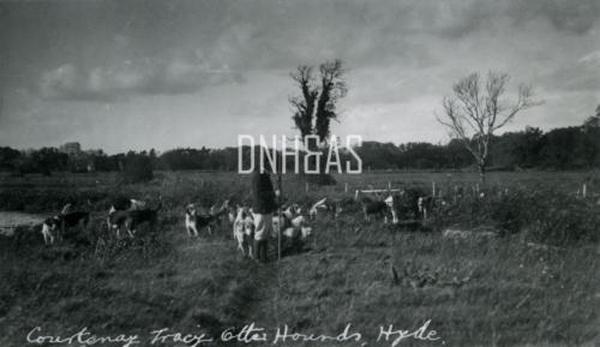
Courteney Tracy Otter Hounds next to the River Piddle, Hyde, 1920s-1930s.
This Photograph is Copyright of Dorset County Museum.
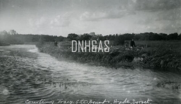
Courteney Tracy Otter Hounds next to the River Piddle, Hyde, 1920s-1930s
This Photograph is Copyright of Dorset County Museum.
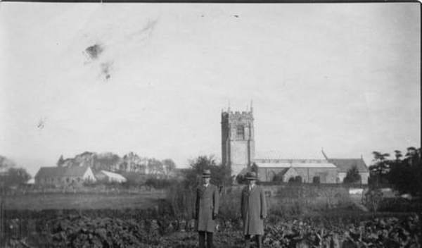
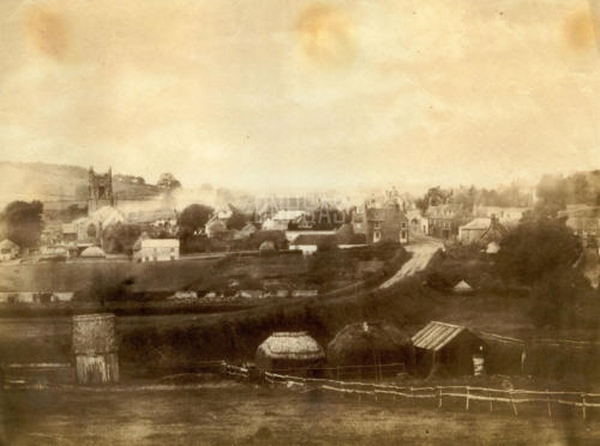
Bere Regis, in 1885, taken from the Gamebook of Mr Charles Harvey Coombs
.jpg "Road junction off of West Street to Milborne St Andew")
Photograph courtesy of Paul Bennett
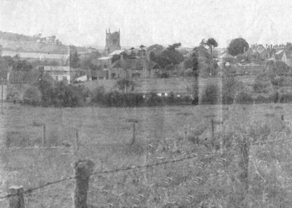
Bere Regis from the South East, 1940s.
This Photograph is taken from a Book called, The Kings England - Dorset - Thomas Hardy's Country, by Arthur Mee, published in 1947.
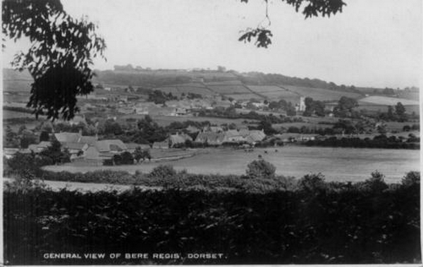
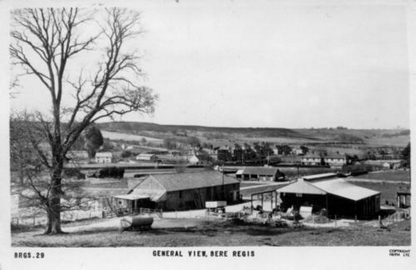
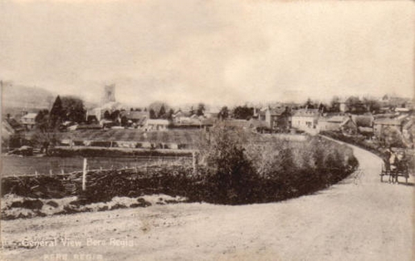
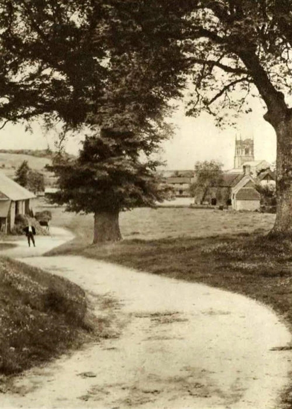
General View of Bere Regis
Sent in by an anonymous user
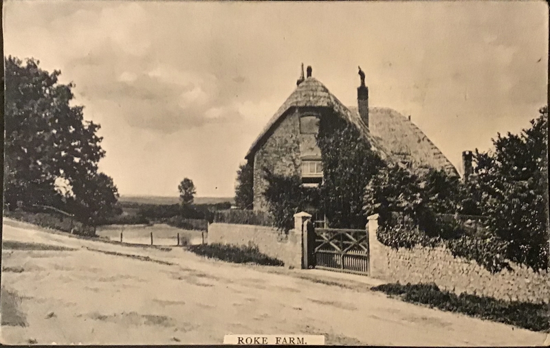
Roke Farm
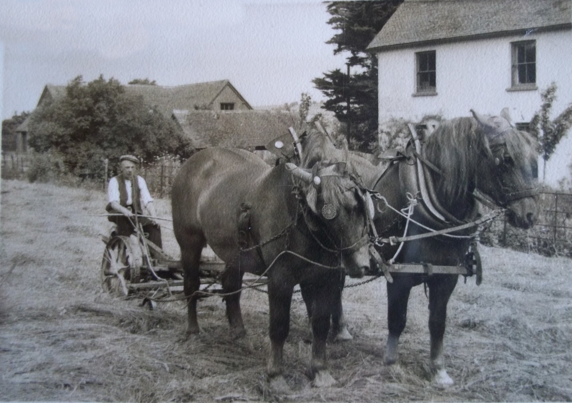
Photo courtesy of Paul Bennett
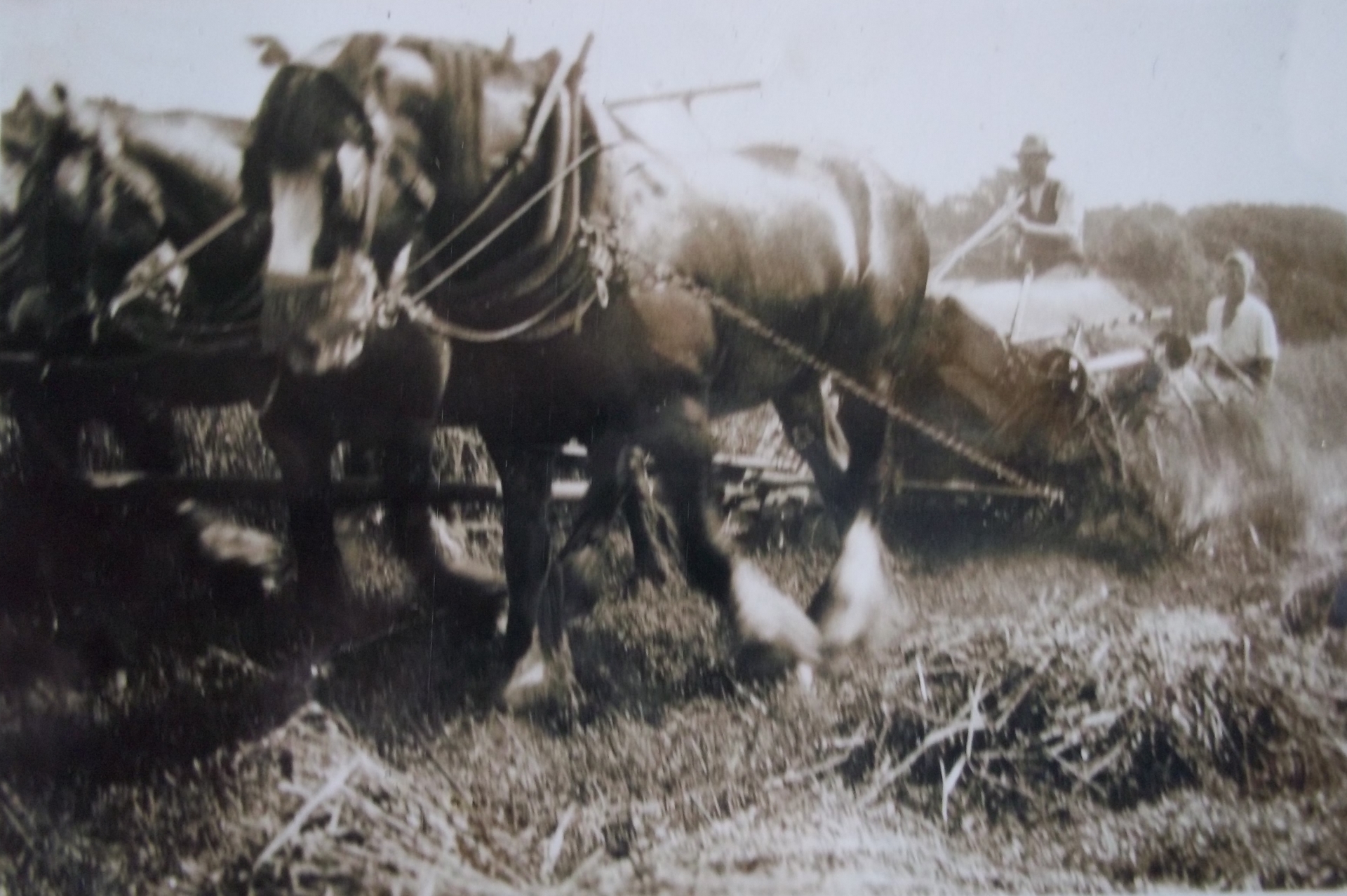
Photo courtesy of Paul Bennett
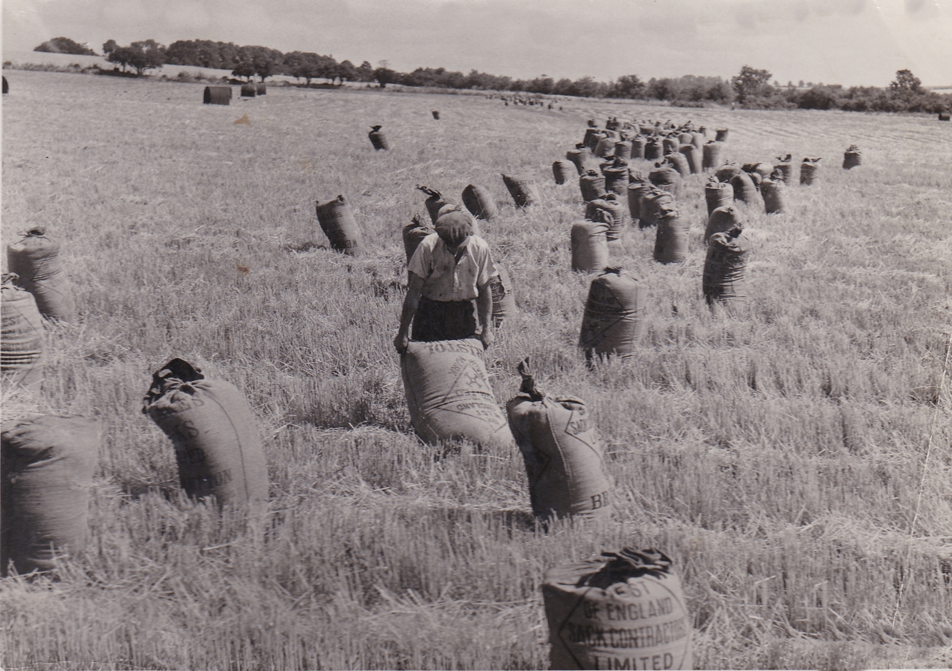
Photo courtesy of Paul Bennett
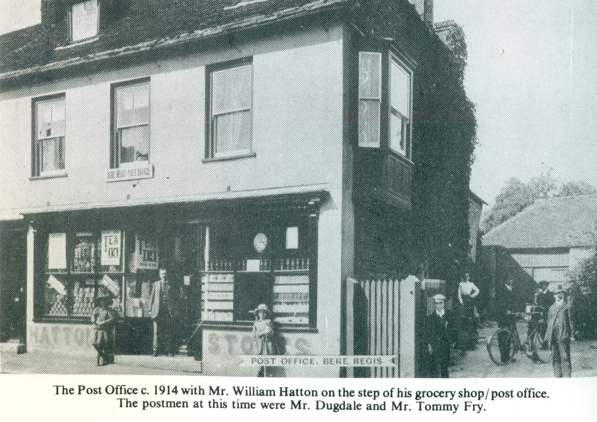
Village shop / Post Office
Photo courtesy of Paul Bennett